
The Vitals
Date: August 1 – 3, 2020
Location: Downton Creek Area (near Lillooet, BC)
Distance: ~29 km
Partners: Anne and Will
Resources: Matt Gunn’s Scrambles Guidebook, 1:50000 topo map 92J09, Bivouac Trip report, Steven Song
The Trip
Before this summer I wanted to try at least a few trips that are not well-established traverses or at least not in any of the guidebooks I’ve looked at. Our trip at the beginning of July around the Sockeye watershed was a start but I wanted at least one more weekend+ length trip.
Will and I discussed visiting the Downton Creek area as we now had a vehicle more capable for logging roads and the Scrambles guidebook suggests there is a lot to explore while only providing a detailed description for Peak 8700 (also known, perhaps unofficially, as Statimcets Peak).

By relying heavily on a trip report from Robin Tivy of Bivouac.com, Will guided us through a short traverse with only one brief section of mandatory scrambling. It began with a bog standard ascent of Peak 8700 through horsefly-infested meadows. The drive had gotten us started at 1600 or so meters so it was only about 45 minutes of hiking through the trees on a hot day to reach the alpine.

Many people were out for summits of 8700 or to complete a one-day traverse to Melvin peak but we were the only group to continue north to camp at one of the dozen or so lakes visible from the ridge. The entire day was only 10 or 12 km and we were finished early enough to enjoy some sunshine and wash in one of the lakes.

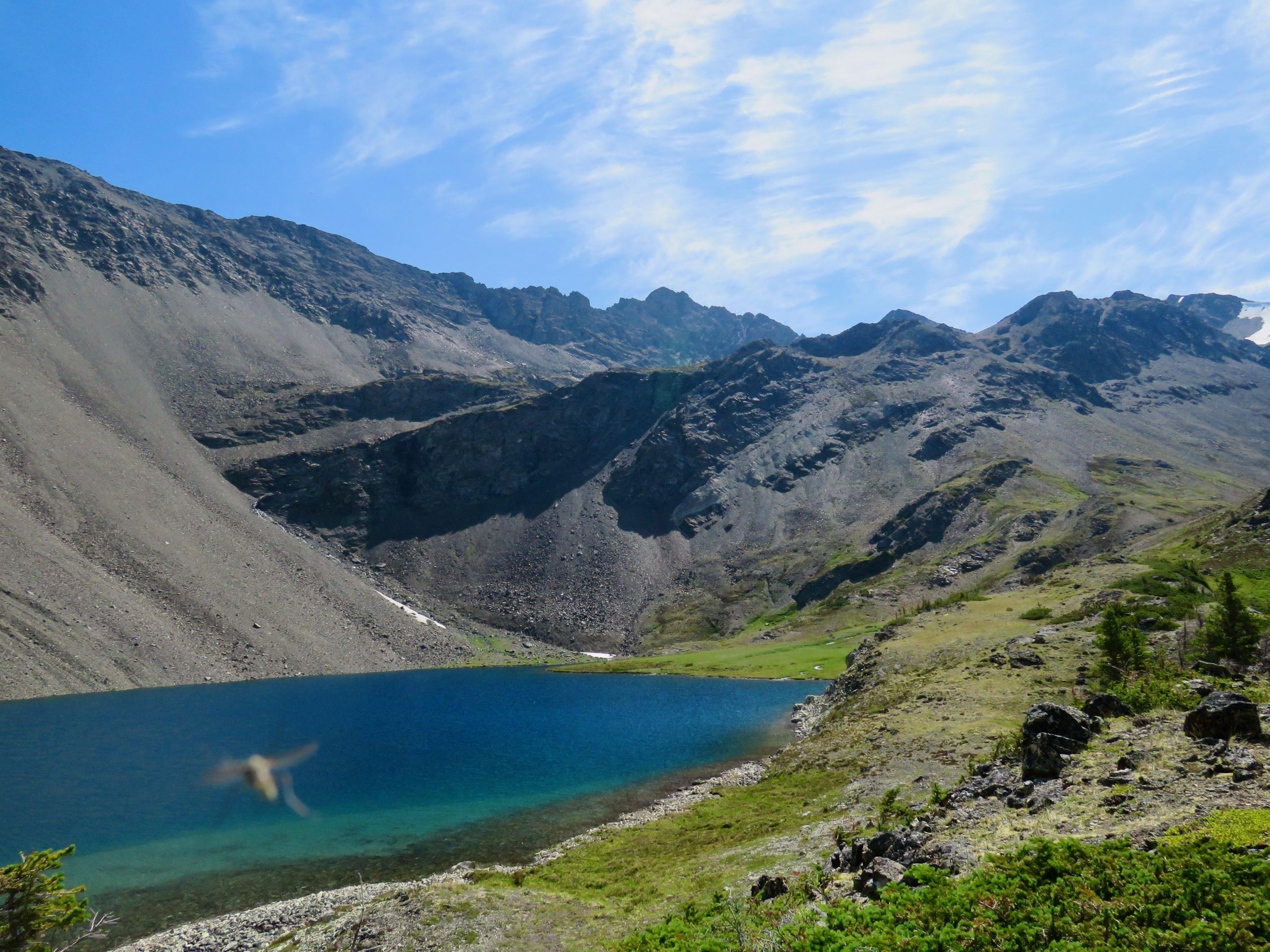
The next day we continued north down into a slightly marshy area before wrapping around a peak through some welcome shade on the scree slopes of its northern side. A short scramble up rocks brought us to a pair of beautiful lakes that would make fine camping. They were about an hour or hour and a half from our camp site and could easily have been reached on day 1.


The only real discussion point on the route was to choose our path through the terrain in the following picture. Our chosen route worked out fine and it was to generally ascend on the left side of the creek with a distinct dog leg on the map. The scrambling was technically easy but the rock is of very poor quality so some finesse was in order.
Once past this section, we easily romped up scree and a bit of snow to the last pass before dropping into the valley that holds the trail to Mt. Seton. We didn’t try to maintain our elevation on the loose sidehills but within an hour we were over a small ridge that overlooks Saddlebag lakes from the south.


From afar, the scree slope up Mt. Seton looked impossibly vertical but slackened off as we got closer. As we headed up to the base of the scree, one of the groups we had met on Peak 8700 the prior day had just finished descending. They had hiked back out and camped on the logging road the night before. While they didn’t have to carry overnight packs, they still hiked nearly as much as us and with a decent amount of elevation.

On the summit, Will found the register and saw that there were seven entries over the last two years, then seven entries in just the prior month. Either the word is out on Seton or the summit register used to be harder to find.

Our last day was just a short 5 km drop down the flagged Seton trail. We lost the trail a couple of times but it got easier to follow as we descended. Having completed a horseshoe, I started to jog back up the logging road to pick up our car but was picked up in a truck after less than 1 km.
I loved this route for its relatively low output, pair of summits, lack of traffic in the middle section, and distinctly different terrain than on the coast.
You must be logged in to post a comment.